GIS Mapping Services
AeGIS Technologies being a GIS Mapping company gathers, organizes and analyses data whether it be spatial or non-spatial. The GIS Mapping services provided by us give important inputs for the purpose of unlocking new insights on information like resource location, demographic behaviour, consumer trends etc. about any place.GIS Mapping services uses CAD, GIS and GPS services for the purpose of gathering and analysing data from resources like land surveys, aerial pictures, etc. The collected data after being organized in 2D or 3D forms is then presented in dynamic maps.The GIS Mapping services help a lot in knowing about property, location or an asset with the help of dynamic data that are geographically arranged. And we being a GIS Mapping Company help many organizations and firms, government departments, geologists, environmentalists etc. for a better tomorrow.
Cadastral Mapping
Cadastral mapping is a record for the details related to the properties in an area. The maps are prepared using cadastral mapping services which helps in easy management of public land records. National and local governmental bodies, real estate developers, architecture, engineering firms, and industries make a proactive use of the cadastral mapping services for making better decisions.
Topographical Mapping
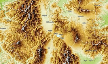
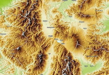
Topographical mapping enables industries when it comes to selection of the smartest route from one place to another. In Topographical mapping we map terrain with contour lines to understand an area's elevation in a better way. Topographic maps are used for energy exploration, natural resource conservation, public works design, environmental management, commercial as well as residential planning, etc.
Parcel Mapping
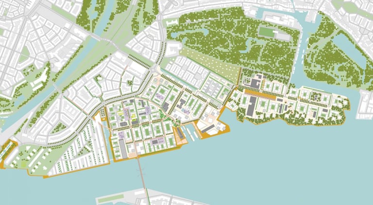
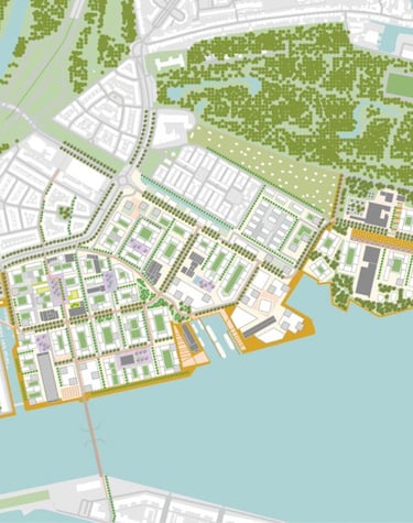
Parcel mapping is the method in which land parcels are prepared using GIS mapping for effective and precise land management. Parcel mapping has a variety of implementations over various industries like land administration & land registration by urban and rural governing agencies. Municipality planning & urban development. The land parcels are the very fundamental data layers used as referenced.
Indoor Mapping


Indoor mapping makes it easier for industries to navigate through from one point to another within a building premise. Indoor mapping saves the user from being lost and clueless in a huge and complex building premise. Polosoft does multidimensional digital maps by overlaying multiple data layers to create scalable, location-aware applications with the creation of IoT-enabled smart buildings.
Utility Mapping
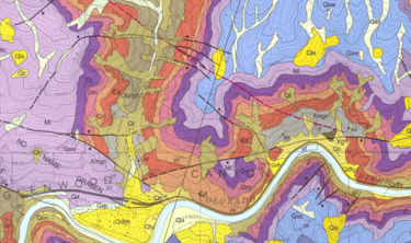
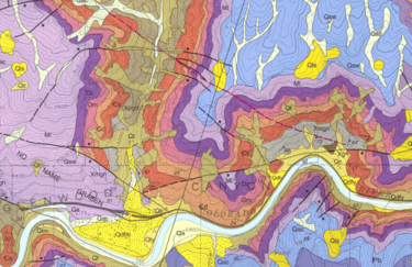
Geological Mapping
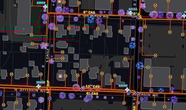
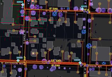
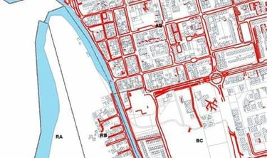
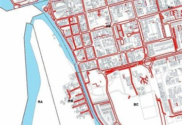
Utility industries have extensive uses of geographic information systems i.e GIS for remote sensing utility mapping services, and computer-aided design which we often know as CAD and drafting technologies for cost-effective functioning. Polosoft Technologies has expertise of years in providing tailored and efficient GIS services for all utility sectors like electrical, water, gas, sewage & telecom
Based on the integrated analysis with satellite data, geo-chemical data, and geophysical data, geological mapping delivers early information related to bedrock geology, helping the geologists during the planning before field works. Polosoft Technologies has huge expertise in providing GIS services in mining sectors and for companies and sectors who are into excavation and mineral management.
LULC Map
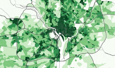
Base Map
Geo Database

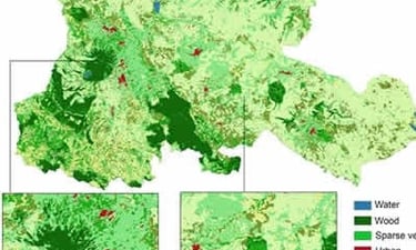


LULC abbreviation for Land Use Land Cover mapping is a part of GIS mapping and which enables experts and professionals by providing them area information for understanding the current landscape. Annual LULC information on national spatial databases enables easy monitoring of temporal dynamics areas such as the agricultural ecosystems, forest conversions, surface water bodies, etc.
This is the graphical representation with a specified scaling for the selected fundamental map information and upon which other additional mapping data of a specialized nature can be compiled. Base mapping finds its usefulness in infrastructure, land base, utility networks, property details etc. creating intelligent GIS maps. Polosoft’s systematic approach in base mapping ensures accuracy.
The geodatabase is the native data structure for GIS mapping and is considered the primary data format for editing and data management. Polosoft works with geographic information in numerous GIS file formats, designed to work with and leverage the capabilities of the geodatabase. Geodatabase is a designed database for storing, querying, and manipulation of GIS and spatial data.
Let's talk
info@aegisgy.com
+67 002 344 13 65